The Hindu : Page 01
Syllabus : GS 3 : Geography & Disaster and disaster Management
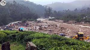
A devastating series of landslides in Vythiri taluk, Wayanad district, Kerala, killed at least 122 people and injured 197, with the death toll expected to rise.

About Wayanad
Possible reasons behind Wayanad Landslide
o Extremely heavy rainfall, a fragile ecology particularly vulnerable to landslides, and steadily increasing population pressures all combined to trigger multiple landslides.
o The region received more than 140 mm of rainfall in the 24 hours between the mornings of Monday and Tuesday, about five times more than what is expected.
o Heavy rains during the monsoon season trigger landslides in Kerala almost every year
o The whole of western Kerala, which is a hilly terrain with sharp slopes, is susceptible to landslides.
o According to the landslide atlas released by the Indian Space Research Organisation's (ISRO) National Remote Sensing Centre in 2023, 10 out of the 30 most landslide-prone districts in India were located in Kerala, with Wayanad ranked 13th.
o The terrain here has two distinctive layers, a layer of soil sitting atop hard rocks.
o When a lot of rain happens, the soil gets saturated with moisture and water reaches the rocks and flows between the soil and the rock layers.
o This weakens the force that binds the soil to the rocks and triggers the movement.
o A 2021 study on landslide hotspots in India revealed that 59 per cent of the total landslides in Kerala occurred in plantation areas.
o Loss of forests increase the fragility of the terrain, especially in areas prone to heavy rains in the western ghats.
o Climate scientists have pointed towards the warming of the Arabian Sea as one of the causes for the extremely heavy and unpredictable rain patterns in the state.
o The southeast Arabian Sea is becoming warmer, causing the atmosphere above this region, including Kerala, to become thermodynamically unstable.
o Scientists have noticed a trend of deep cloud systems forming due to the warming of the Arabian sea.
o This causes extremely heavy spells of rain in shorter periods of time, increasing the risk of landslides, especially when these intrude into land.
o Since 2011, the "Western Ghats Ecology Expert Panel" set up by the government under ecologist Madhav Gadgil, has recommended that the Wayanad hill ranges be declared ecologically sensitive.
o The panel recommended that 75% of the 129,037 sq km area of the mountain range be declared ecologically sensitive because of the presence of dense forests, a large number of endemic species and unique geology.
o The panel also said that the region needed to be divided into zones based on their ecological sensitivity, where the most vulnerable sections needed to be monitored and protected him from rampant commercial activity.
o They recommended a ban on mining, quarrying, new thermal power plants, hydropower projects and large-scale wind energy projects in ecologically sensitive zone 1.
o The suggestions made by the panel have not been implemented even after 14 years due to resistance from state governments, industries and local communities.
Ways to reduce instances of landslides:
Key Policy Initiative: National Landslide Susceptibility Map
Top States by Landslide Events:
Districts with Maximum Landslide Exposure:
Highest Landslide Density and Risk Exposure:
UPSC Mains PYQ : 2021
Ques : Describe the various causes and the effects of landslides. Mention the important components of the National Landslide Risk Management Strategy.
