National Waterways in India
o However, these inland waterways have been unutilised, as compared to other countries in the world.
o Out of the 111, National Waterways declared under the National Waterways Act, 2016, 13 are operational for shipping and navigation and cargo/passenger vessels are moving on them.
Inland Waterways Authority of India
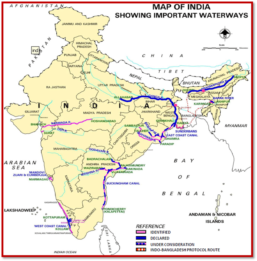
National Waterways
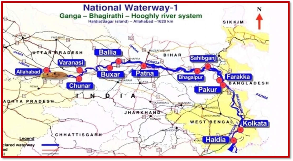
o It starts from Allahabad(Prayagraj) to Haldia with a distance of 1620 km.
o The NW 1 run through the Ganges, Bhagirathi, and Hooghly river system with having fixed terminals at Haldia, Farrakka, and Patna and floating terminals at most of the riverside cities like Kolkata, Bhagalpur, Varanasi, and Allahabad.
o It is be the longest National Waterways in India.
o It is a stretch on the Brahmaputra river from Sadiya to Dhubri in Assam state.
o The NW 2 is one of the major freight transportation waterways of northeast India and the third-longest Waterways with and a total length of 891 km.
Mapping : National Waterways in India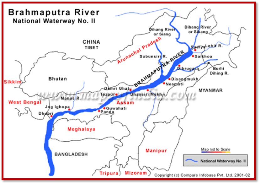
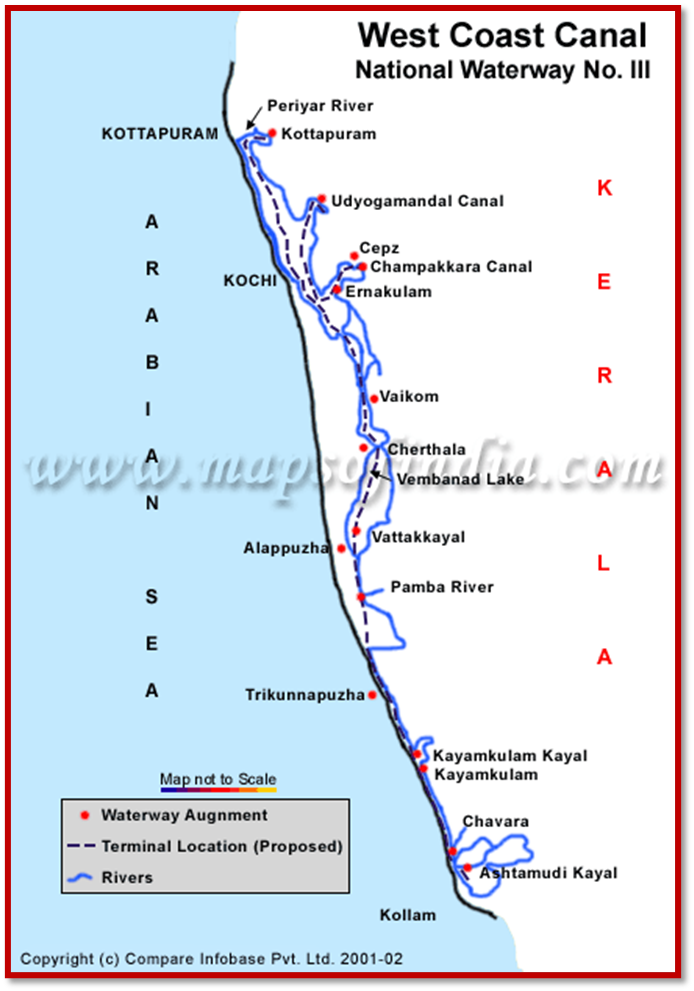
o It is located in Kerala state and runs from Kollam to Kottapuram.
o The 205 km long West Coast Canal is India’s first waterway with all-time navigation facility.
o The NW3 is consists of the West Coast Canal, Champakara Canal, and Udyogmandal Canal and runs through Kottappuram, Cherthala, Thrikkunnapuzha Kollam, and Alappuzha.
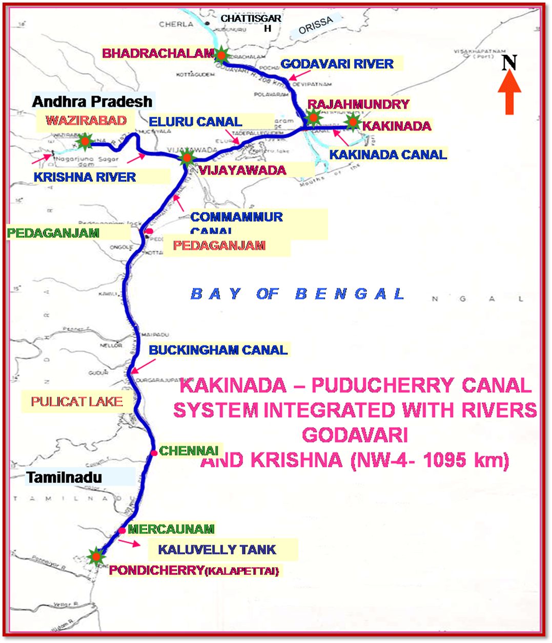
o It is connected from Kakinada to Pondicherry through Canals, Tank, and River Godavari along with Krishna river.
o The NW 4 the second-longest waterway of India with a total length of 1095 km in Andhra Pradesh and Tamil Nadu.
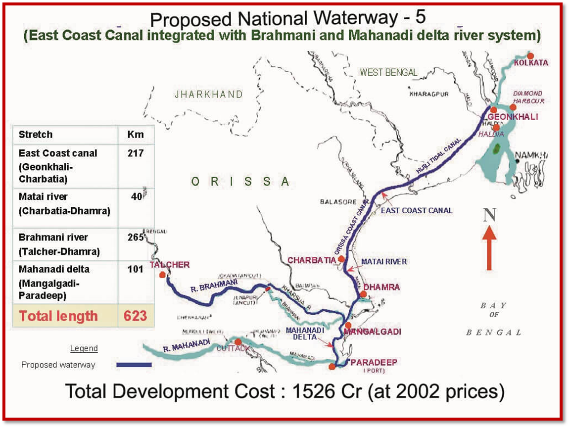
o It connects Orissa to West Bengal using the stretch on Brahmani River, East Coast Canal, Matai river, and Mahanadi River Delta.
o The 623 km long canal system will handle the traffic of cargo such as coal, fertilizer, cement, and iron.
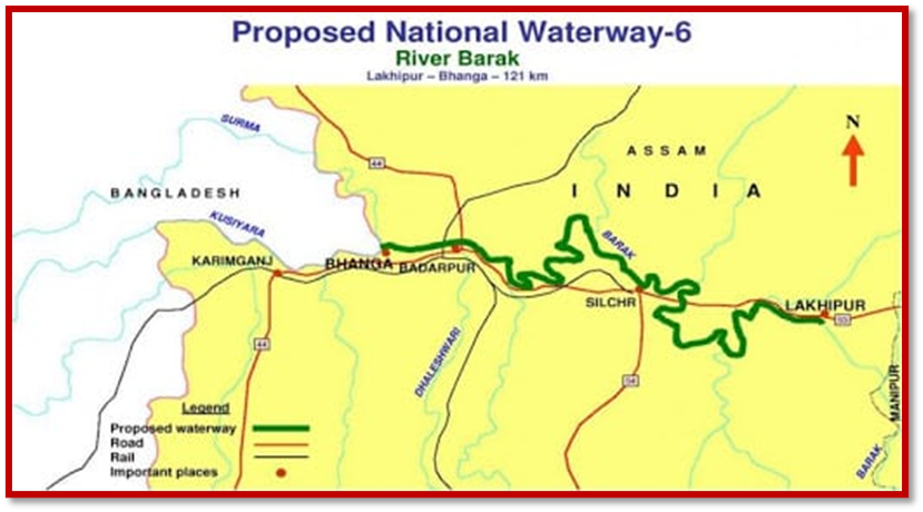
o It is the proposed waterway in Assam state and will connect Lakhipur to Bhanga in river Barak.
o The 121 km long waterway will help in trading between the town of Silchar to Mizoram State.
